
Inland-waterway careers are about much more than steering a vessel. A working river corridor needs people who can measure its depth, keep navigation equipment reliable, move goods through terminals and connect river transport with roads and railways. For students and career changers, the useful question is which part of that chain fits their skills.
Why river transport needs a broad workforce
India’s national-waterway network includes 111 declared waterways covering 20,187 km. Government reporting in 2026 identifies 32 operational waterways and records 218 million metric tonnes of cargo in 2025–26. Declaring a waterway and operating a dependable freight service are different stages: surveys, usable depths, terminals, vessels and commercial demand all matter.
Waterways can complement road and rail for suitable freight. A river shipment still needs a practical first and last mile, so employment can also arise in warehouses, transport scheduling, cargo handling and local services. These are sector opportunities, not an announcement that a particular number of jobs is open.
Surveying: understanding what is below the surface
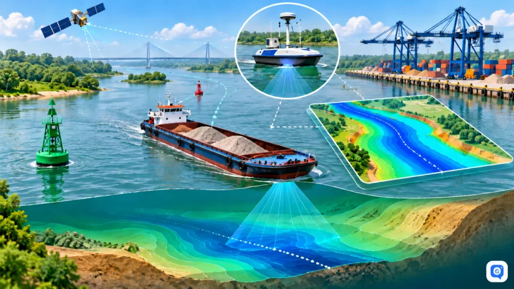
A river channel changes with sediment and flow. Hydrographic teams measure depths and bed conditions, identify hazards and turn field observations into information that vessel operators can use. The least available depth helps operators judge how much draft a route can support; it is a navigation constraint rather than a promise that every vessel can pass.
Students interested in this work can explore civil or marine engineering, geography, hydrography and geospatial study. Practical skills in surveying, GIS, data quality, chart interpretation and careful field recording are useful starting points. Check the qualification specified in an actual vacancy before enrolling in a course advertised as a guaranteed job route.
Navigation aids, electronics and digital systems
Buoys, beacons, channel markers and lighthouses help make navigation safer, including at night. Their installation and maintenance require electrical, electronics, mechanical and technical skills. Solar-powered equipment can reduce dependence on local power connections, but equipment still needs inspection and maintenance.
Digital charts and river-information systems add another layer. Electronic Navigational Charts present survey information for route planning. IWAI’s PANI portal, vessel-tracking tools and Naudarshika initiative bring route, asset and navigation information into digital workflows. Teams need reliable data and communication as well as software: a clean interface cannot compensate for an inaccurate survey.
Projects to follow without confusing them with recruitment
The Jal Marg Vikas Project on National Waterway-1 illustrates how fairway work, terminals, jetties and a navigation lock support a wider logistics corridor. The Brahmaputra riverine-lighthouse initiative links navigation safety with proposed visitor facilities and local tourism. A project announcement may later create contractor, consultancy or operating opportunities, but it is not itself an application form.
Private terminals and public-private partnerships can add roles in construction, operations and maintenance. The Jalvahak incentive scheme supports eligible cargo movements; it is a business-support measure rather than a personal employment allowance. Applicants and businesses should consult the applicable official conditions.
The feature describes four planned Brahmaputra riverine lighthouses at Pandu, Bogibeel, Silghat and Biswanath Ghat, with an announced project cost of Rs 74 crore. The proposed 20-metre towers combine solar-powered navigation support, weather sensors and visitor facilities. These are announced project features, not a claim that construction or recruitment is complete.
The National Waterways(Construction of Jetties/Terminals)Regulations,2025 and Jal Samriddhi portal concern permissions and private participation in terminal development. Longer-term Maritime Amrit Kaal Vision 2047 aims include a 5%inland-water-transport freight share, over 500 MMTcargo and more than 50 operational National Waterways. Such targets describe policy direction, not guaranteed outcomes or jobs.
Choose a route that matches your interests
- Field and engineering work: investigate surveying, river engineering, dredging support and civil or mechanical maintenance.
- Technical systems: look at electronics, communication equipment, GIS and digital-navigation support.
- Operations: consider cargo handling, logistics coordination, warehousing, vessel or terminal operations and transport planning.
- Local services: ferry services, river tourism, boat maintenance and related small businesses can matter beyond large transport hubs.
A practical next step
- Read current vacancies and tenders on IWAI and the Ministry’s official websites. Separate permanent recruitment, deputation, contractual engagement and business tenders.
- Compare your present qualification with the exact essential conditions. Field-safety, medical or vessel-certification requirements may apply to operational roles.
- Build evidence of relevant work: a supervised survey exercise, GIS project, maintenance log, logistics case study or internship can explain your skills more clearly than a generic course certificate.
- Follow project updates, but apply only through the authority or contractor’s verified recruitment channel.
What should the community discuss?
Have you studied surveying, worked at a terminal or explored a logistics course? Share what the training actually involved, which skills were used and where official entry requirements were published. Avoid promises of assured selection or requests for someone else’s identity documents.
Official sources
- Ministry of Ports, Shipping and Waterways: Inland Water Transport
- Inland Waterways Authority of India
- PIB: National waterways and cargo movement, 11 August 2026
Discuss this topic
Ask a question or share a source-based answer in the community discussion.
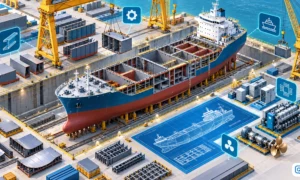
Cover image: AI-generated editorial illustration, not an official recruitment notice.